
Thank you for supporting this site ❤️
Make a donation
Make a donation
Amity topographic map
Click on the map to display elevation.
Thank you for supporting this site ❤️
Make a donation
Make a donation
About this map
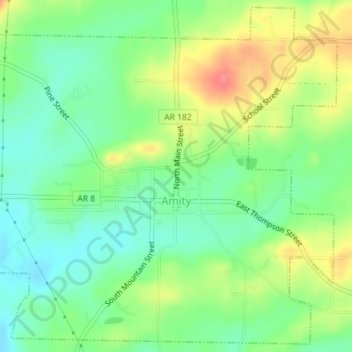
Name: Amity topographic map, elevation, terrain.
Location: Amity, Clark County, Arkansas, United States (34.25278 -93.48030 34.28101 -93.44468)
Average elevation: 163 m
Minimum elevation: 134 m
Maximum elevation: 207 m
Thank you for supporting this site ❤️
Make a donation
Make a donation
Other topographic maps
Click on a map to view its topography, its elevation and its terrain.