
Thank you for supporting this site ❤️
Make a donation
Make a donation
Kasota topographic map
Click on the map to display elevation.
Thank you for supporting this site ❤️
Make a donation
Make a donation
About this map
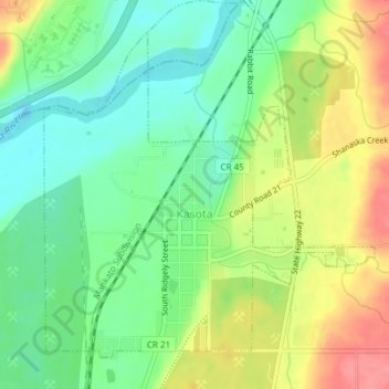
Name: Kasota topographic map, elevation, terrain.
Location: Kasota, Le Sueur County, Minnesota, United States (44.28251 -93.97961 44.30509 -93.94747)
Average elevation: 255 m
Minimum elevation: 222 m
Maximum elevation: 302 m
Thank you for supporting this site ❤️
Make a donation
Make a donation
Other topographic maps
Click on a map to view its topography, its elevation and its terrain.