
Thank you for supporting this site ❤️
Make a donation
Make a donation
Almora District topographic map
Click on the map to display elevation.
Thank you for supporting this site ❤️
Make a donation
Make a donation
About this map
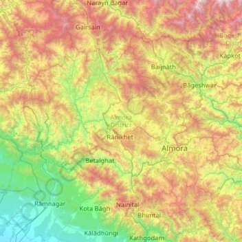
Name: Almora District topographic map, elevation, terrain.
Location: Almora District, Uttarakhand, India (29.42548 79.03710 29.97971 80.07791)
Average elevation: 1,443 m
Minimum elevation: 236 m
Maximum elevation: 3,915 m
Thank you for supporting this site ❤️
Make a donation
Make a donation