
La Vigne topographic map
Interactive map
Click on the map to display elevation.
About this map
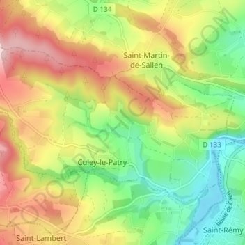
Name: La Vigne topographic map, elevation, terrain.
Average elevation: 136 m
Minimum elevation: 26 m
Maximum elevation: 269 m
Other topographic maps
Click on a map to view its topography, its elevation and its terrain.
Le Carcanet
France > Normandie > Calvados > Culey-le-Patry
Le Carcanet, Culey-le-Patry, Caen, Calvados, Normandie, France métropolitaine, 14220, France
Average elevation: 171 m