
Les Porées topographic map
Interactive map
Click on the map to display elevation.
About this map
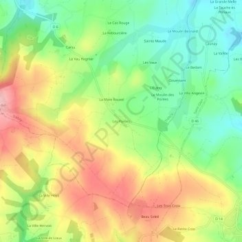
Name: Les Porées topographic map, elevation, terrain.
Average elevation: 250 m
Minimum elevation: 175 m
Maximum elevation: 340 m
Other topographic maps
Click on a map to view its topography, its elevation and its terrain.
Mont Bel-Air
France > Bretagne > Côtes-d'Armor > Trébry
Mont Bel-Air, Trébry, Saint-Brieuc, Côtes-d'Armor, Bretagne, France métropolitaine, 22510, France
Average elevation: 278 m