
Filzen topographic map
Interactive map
Click on the map to display elevation.
About this map
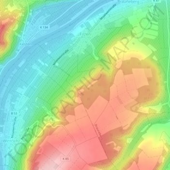
Name: Filzen topographic map, elevation, terrain.
Average elevation: 198 m
Minimum elevation: 110 m
Maximum elevation: 321 m
Other topographic maps
Click on a map to view its topography, its elevation and its terrain.
Brauneberg
Deutschland > Rheinland-Pfalz > Landkreis Bernkastel-Wittlich > Brauneberg
Brauneberg, Bernkastel-Kues, Landkreis Bernkastel-Wittlich, Rheinland-Pfalz, Deutschland
Average elevation: 290 m