
永宁街道 topographic map
Interactive map
Click on the map to display elevation.
About this map
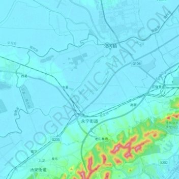
Name: 永宁街道 topographic map, elevation, terrain.
Location: 永宁街道, 浦口区, 南京市, 江苏省, 中国 (32.11120 118.48982 32.21115 118.67732)
Average elevation: 27 m
Minimum elevation: 4 m
Maximum elevation: 319 m
Other topographic maps
Click on a map to view its topography, its elevation and its terrain.