
La Barraude topographic map
Interactive map
Click on the map to display elevation.
About this map
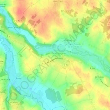
Name: La Barraude topographic map, elevation, terrain.
Average elevation: 90 m
Minimum elevation: 62 m
Maximum elevation: 119 m
Other topographic maps
Click on a map to view its topography, its elevation and its terrain.
Le Picote
France > Nouvelle-Aquitaine > Charente > Val-de-Bonnieure
Le Picote, Sainte-Colombe, Val-de-Bonnieure, Confolens, Charente, Nouvelle-Aquitaine, France métropolitaine, 16230, France
Average elevation: 96 m
Sainte-Colombe
France > Nouvelle-Aquitaine > Charente > Val-de-Bonnieure
Sainte-Colombe, Val-de-Bonnieure, Confolens, Charente, Nouvelle-Aquitaine, France métropolitaine, 16230, France
Average elevation: 98 m