
Thank you for supporting this site ❤️
Make a donation
Make a donation
Lone Elm topographic map
Click on the map to display elevation.
Thank you for supporting this site ❤️
Make a donation
Make a donation
About this map
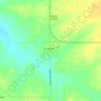
Name: Lone Elm topographic map, elevation, terrain.
Location: Lone Elm, Anderson County, Kansas, United States (38.07714 -95.24533 38.08181 -95.24067)
Average elevation: 337 m
Minimum elevation: 324 m
Maximum elevation: 349 m
Thank you for supporting this site ❤️
Make a donation
Make a donation
Other topographic maps
Click on a map to view its topography, its elevation and its terrain.