
钟山风景名胜区环境综合整治纪念碑 topographic map
Interactive map
Click on the map to display elevation.
About this map
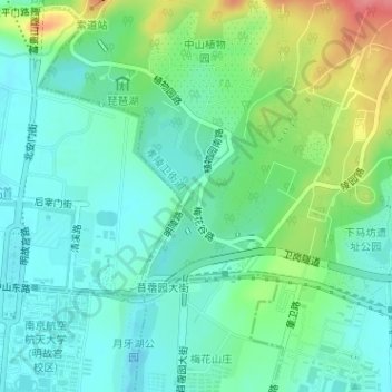
Name: 钟山风景名胜区环境综合整治纪念碑 topographic map, elevation, terrain.
Location: 钟山风景名胜区环境综合整治纪念碑, 孝陵卫街道, 玄武区, 南京市, 江苏省, 中国 (32.04747 118.82735 32.04789 118.82778)
Average elevation: 32 m
Minimum elevation: 6 m
Maximum elevation: 96 m
Other topographic maps
Click on a map to view its topography, its elevation and its terrain.
中国科学院紫金山天文台
中国科学院紫金山天文台, 天文台小道, 孝陵卫街道, 玄武区, 南京市, 江苏省, 210016, 中国
Average elevation: 89 m