
Thank you for supporting this site ❤️
Make a donation
Make a donation
Castanheira de Pera topographic map
Click on the map to display elevation.
Thank you for supporting this site ❤️
Make a donation
Make a donation
About this map
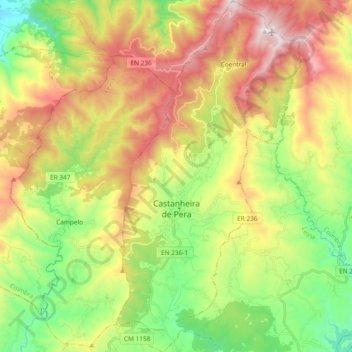
Name: Castanheira de Pera topographic map, elevation, terrain.
Location: Castanheira de Pera, Leiria, Portugal (39.94595 -8.24146 40.08974 -8.14263)
Average elevation: 610 m
Minimum elevation: 160 m
Maximum elevation: 1,202 m
Thank you for supporting this site ❤️
Make a donation
Make a donation
Other topographic maps
Click on a map to view its topography, its elevation and its terrain.