
Thank you for supporting this site ❤️
Make a donation
Make a donation
Hulsberg topographic map
Click on the map to display elevation.
Thank you for supporting this site ❤️
Make a donation
Make a donation
About this map
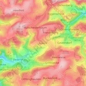
Name: Hulsberg topographic map, elevation, terrain.
Average elevation: 381 m
Minimum elevation: 254 m
Maximum elevation: 449 m
Thank you for supporting this site ❤️
Make a donation
Make a donation
Other topographic maps
Click on a map to view its topography, its elevation and its terrain.
Rahmede
Deutschland > Nordrhein-Westfalen > Märkischer Kreis > Lüdenscheid > Gevelndorf
Average elevation: 375 m