
אשדוד topographic map
Interactive map
Click on the map to display elevation.
About this map
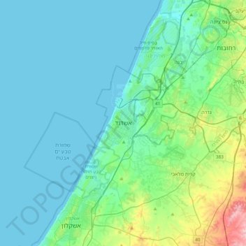
Name: אשדוד topographic map, elevation, terrain.
Location: אשדוד, נפת אשקלון, 南部区, 7750502, 以色列 (31.63773 34.49299 31.95773 34.81299)
Average elevation: 31 m
Minimum elevation: -1 m
Maximum elevation: 200 m
Other topographic maps
Click on a map to view its topography, its elevation and its terrain.