
Thank you for supporting this site ❤️
Make a donation
Make a donation
Memmingen topographic map
Click on the map to display elevation.
Thank you for supporting this site ❤️
Make a donation
Make a donation
About this map
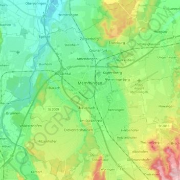
Name: Memmingen topographic map, elevation, terrain.
Location: Memmingen, Bavaria, 87700, Germany (47.91551 10.08477 48.04749 10.23395)
Average elevation: 617 m
Minimum elevation: 553 m
Maximum elevation: 764 m
Thank you for supporting this site ❤️
Make a donation
Make a donation
Other topographic maps
Click on a map to view its topography, its elevation and its terrain.