
Timelyiouine topographic map
Interactive map
Click on the map to display elevation.
About this map
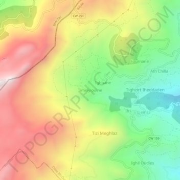
Name: Timelyiouine topographic map, elevation, terrain.
Average elevation: 1,067 m
Minimum elevation: 511 m
Maximum elevation: 1,675 m
Other topographic maps
Click on a map to view its topography, its elevation and its terrain.
Ighbane
Algérie > Béjaïa > Daïra Ifri Ouzellaguen > Ouzellaguen
Ighbane, Ouzellaguen, Daïra Ifri Ouzellaguen, Béjaïa, 06010, Algérie
Average elevation: 1,020 m
Ifri
Algérie > Béjaïa > Daïra Ifri Ouzellaguen > Ouzellaguen
Ifri, Ouzellaguen, Daïra Ifri Ouzellaguen, Béjaïa, 06010, Algérie
Average elevation: 888 m