
Thank you for supporting this site ❤️
Make a donation
Make a donation
Vale de Vilão topographic map
Click on the map to display elevation.
Thank you for supporting this site ❤️
Make a donation
Make a donation
About this map
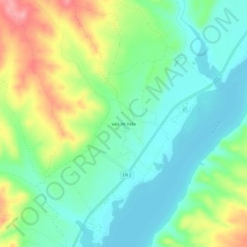
Name: Vale de Vilão topographic map, elevation, terrain.
Location: Vale de Vilão, Montargil, Ponte de Sor, Portalegre, Portugal (39.12004 -8.14001 39.16004 -8.10001)
Average elevation: 110 m
Minimum elevation: 73 m
Maximum elevation: 183 m
Thank you for supporting this site ❤️
Make a donation
Make a donation
Other topographic maps
Click on a map to view its topography, its elevation and its terrain.