
What Cheer topographic map
Interactive map
Click on the map to display elevation.
About this map
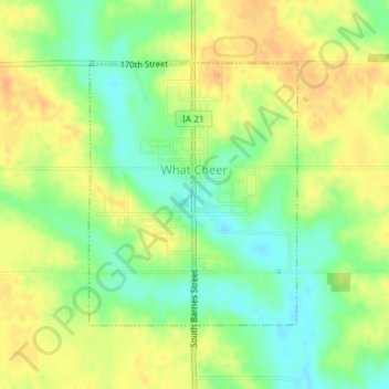
Name: What Cheer topographic map, elevation, terrain.
Location: What Cheer, Keokuk County, Iowa, United States (41.39055 -92.36438 41.40883 -92.34502)
Average elevation: 243 m
Minimum elevation: 224 m
Maximum elevation: 259 m
Other topographic maps
Click on a map to view its topography, its elevation and its terrain.
Kinross
United States > Iowa > Keokuk County
Kinross, Keokuk County, Iowa, United States
Average elevation: 243 m