
Natabuela topographic map
Interactive map
Click on the map to display elevation.
About this map
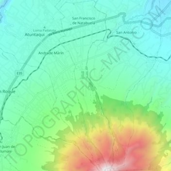
Name: Natabuela topographic map, elevation, terrain.
Location: Natabuela, Atuntaqui, Imbabura, 100217, Ecuador (0.25992 -78.20601 0.34951 -78.17668)
Average elevation: 2,734 m
Minimum elevation: 2,141 m
Maximum elevation: 4,535 m
Other topographic maps
Click on a map to view its topography, its elevation and its terrain.
Parque de Natabuela
Ecuador > Imbabura > Atuntaqui
Parque de Natabuela, Barrio Central, Natabuela, Atuntaqui, Imbabura, Ecuador
Average elevation: 2,411 m