
Thank you for supporting this site ❤️
Make a donation
Make a donation
Stockett topographic map
Click on the map to display elevation.
Thank you for supporting this site ❤️
Make a donation
Make a donation
About this map
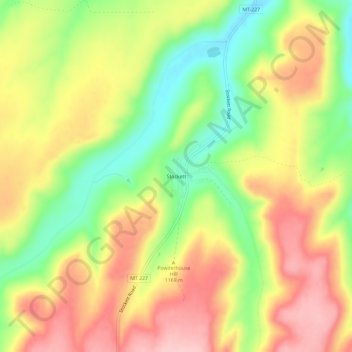
Name: Stockett topographic map, elevation, terrain.
Location: Stockett, Cascade County, Montana, 59480, United States (47.33555 -111.18674 47.37555 -111.14674)
Average elevation: 1,163 m
Minimum elevation: 1,071 m
Maximum elevation: 1,247 m
Thank you for supporting this site ❤️
Make a donation
Make a donation
Other topographic maps
Click on a map to view its topography, its elevation and its terrain.