
Bréry topographic map
Interactive map
Click on the map to display elevation.
About this map
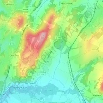
Name: Bréry topographic map, elevation, terrain.
Average elevation: 286 m
Minimum elevation: 224 m
Maximum elevation: 396 m
Climatologie (relevés 1990-2009, station altitude 285 m, moyennes durant ces 20 années).
Other topographic maps
Click on a map to view its topography, its elevation and its terrain.
Domblans
France > Bourgogne-Franche-Comté > Jura > Domblans
Domblans, Lons-le-Saunier, Jura, Bourgogne-Franche-Comté, France métropolitaine, 39210, France
Average elevation: 297 m
Château de la Muyre
France > Bourgogne-Franche-Comté > Jura > Domblans > La Muyre
Château de la Muyre, Rue du Château, La Muyre, Domblans, Lons-le-Saunier, Jura, Bourgogne-Franche-Comté, France métropolitaine, 39210, France
Average elevation: 257 m