
Thank you for supporting this site ❤️
Make a donation
Make a donation
Pinheiro topographic map
Click on the map to display elevation.
Thank you for supporting this site ❤️
Make a donation
Make a donation
About this map
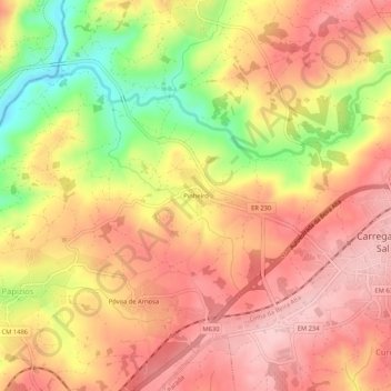
Name: Pinheiro topographic map, elevation, terrain.
Location: Pinheiro, Carregal do Sal, Viseu, 3430-056, Portugal (40.41815 -8.04817 40.45815 -8.00817)
Average elevation: 248 m
Minimum elevation: 127 m
Maximum elevation: 320 m
Thank you for supporting this site ❤️
Make a donation
Make a donation
Other topographic maps
Click on a map to view its topography, its elevation and its terrain.