
绥中县 topographic map
Interactive map
Click on the map to display elevation.
About this map
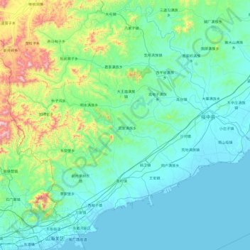
Name: 绥中县 topographic map, elevation, terrain.
Location: 绥中县, 葫芦岛市, 辽宁省, 中国 (39.98926 119.58081 40.61737 120.51641)
Average elevation: 165 m
Minimum elevation: -2 m
Maximum elevation: 1,170 m
Other topographic maps
Click on a map to view its topography, its elevation and its terrain.