
Aletschhorn topographic map
Interactive map
Click on the map to display elevation.
About this map
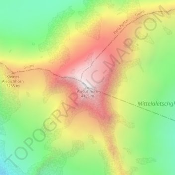
Name: Aletschhorn topographic map, elevation, terrain.
Location: Aletschhorn, Naters, Brig, Wallis, Schweiz (46.46515 7.99316 46.46525 7.99326)
Average elevation: 3,429 m
Minimum elevation: 2,770 m
Maximum elevation: 4,161 m
Other topographic maps
Click on a map to view its topography, its elevation and its terrain.