
Thank you for supporting this site ❤️
Make a donation
Make a donation
Sarahan topographic map
Click on the map to display elevation.
Thank you for supporting this site ❤️
Make a donation
Make a donation
Sarahan
Sarahan is located at 31°31′N 77°48′E / 31.52°N 77.80°E / 31.52; 77.80. It has an average elevation of 2,313 metres (7,589 feet).
Thank you for supporting this site ❤️
Make a donation
Make a donation
About this map
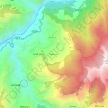
Name: Sarahan topographic map, elevation, terrain.
Location: Sarahan, Rampur, Shimla, Himachal Pradesh, 172101, India (31.46934 77.75301 31.54934 77.83301)
Average elevation: 2,204 m
Minimum elevation: 1,082 m
Maximum elevation: 3,902 m
Thank you for supporting this site ❤️
Make a donation
Make a donation
Other topographic maps
Click on a map to view its topography, its elevation and its terrain.