
Krcevac topographic map
Interactive map
Click on the map to display elevation.
About this map
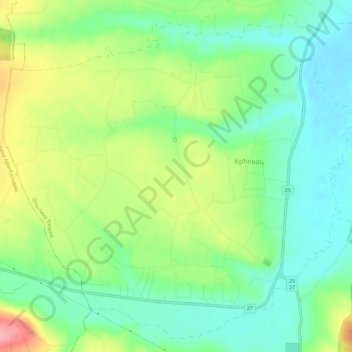
Name: Krcevac topographic map, elevation, terrain.
Average elevation: 179 m
Minimum elevation: 140 m
Maximum elevation: 247 m
Other topographic maps
Click on a map to view its topography, its elevation and its terrain.
Topola
Serbia > Central Serbia > Sumadija Administrative District > Topola Municipality
Average elevation: 245 m