
Thank you for supporting this site ❤️
Make a donation
Make a donation
Elzele topographic map
Click on the map to display elevation.
Thank you for supporting this site ❤️
Make a donation
Make a donation
About this map
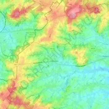
Name: Elzele topographic map, elevation, terrain.
Location: Elzele, Aat, Henegouwen, Wallonië, België (50.70300 3.63775 50.77348 3.70696)
Average elevation: 78 m
Minimum elevation: 29 m
Maximum elevation: 160 m
Thank you for supporting this site ❤️
Make a donation
Make a donation
Other topographic maps
Click on a map to view its topography, its elevation and its terrain.
Thank you for supporting this site ❤️
Make a donation
Make a donation
Thank you for supporting this site ❤️
Make a donation
Make a donation