
Bourke topographic map
Interactive map
Click on the map to display elevation.
About this map
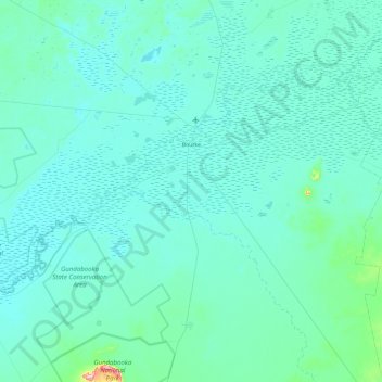
Name: Bourke topographic map, elevation, terrain.
Location: Bourke, Bourke Shire Council, 新南威尔士州, 2840, 澳大利亚 / 澳洲 (-30.54229 145.51414 -29.84220 146.47136)
Average elevation: 117 m
Minimum elevation: 96 m
Maximum elevation: 476 m
Other topographic maps
Click on a map to view its topography, its elevation and its terrain.
Barringun
澳大利亚 / 澳洲 > 新南威尔士州 > Bourke Shire Council
Barringun, Bourke Shire Council, 新南威尔士州, 2840, 澳大利亚 / 澳洲
Average elevation: 146 m