
Le Cuzool topographic map
Interactive map
Click on the map to display elevation.
About this map
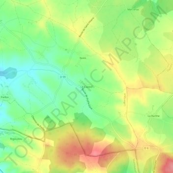
Name: Le Cuzool topographic map, elevation, terrain.
Average elevation: 288 m
Minimum elevation: 245 m
Maximum elevation: 339 m
Other topographic maps
Click on a map to view its topography, its elevation and its terrain.
Pechpeyroux
France > Occitanie > Lot > Lalbenque
Pechpeyroux, Lalbenque, Cahors, Lot, Occitanie, France métropolitaine, 46230, France
Average elevation: 264 m