
Linard topographic map
Interactive map
Click on the map to display elevation.
About this map
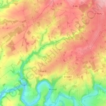
Name: Linard topographic map, elevation, terrain.
Average elevation: 329 m
Minimum elevation: 246 m
Maximum elevation: 392 m
Other topographic maps
Click on a map to view its topography, its elevation and its terrain.
Malval
France > Nouvelle-Aquitaine > Creuse > Linard-Malval
Malval, Linard-Malval, Guéret, Creuse, Nouvelle-Aquitaine, France métropolitaine, 23220, France
Average elevation: 316 m