
Thank you for supporting this site ❤️
Make a donation
Make a donation
Brandberg topographic map
Click on the map to display elevation.
Thank you for supporting this site ❤️
Make a donation
Make a donation
About this map
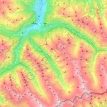
Name: Brandberg topographic map, elevation, terrain.
Location: Brandberg, Bezirk Schwaz, Tyrol, Austria (47.04703 11.86982 47.18425 12.13602)
Average elevation: 1,922 m
Minimum elevation: 587 m
Maximum elevation: 3,353 m
Thank you for supporting this site ❤️
Make a donation
Make a donation
Other topographic maps
Click on a map to view its topography, its elevation and its terrain.
Thank you for supporting this site ❤️
Make a donation
Make a donation
Thank you for supporting this site ❤️
Make a donation
Make a donation
Thank you for supporting this site ❤️
Make a donation
Make a donation