
Bad Zurzach topographic map
Interactive map
Click on the map to display elevation.
Bad Zurzach
La ville est située sur les bords de Rhin, à une altitude de 339 mètres, face à la bourgade allemande de Rheinheim.
About this map
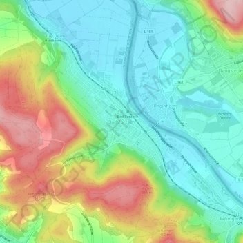
Name: Bad Zurzach topographic map, elevation, terrain.
Location: Bad Zurzach, Zurzach, Bezirk Zurzach, Argovie, 5330, Suisse (47.56665 8.27407 47.60665 8.31407)
Average elevation: 394 m
Minimum elevation: 316 m
Maximum elevation: 540 m