
Balbriggan topographic map
Click on the map to display elevation.
About this map
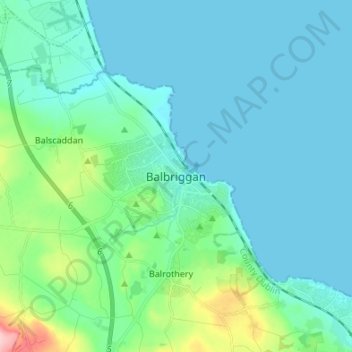
Name: Balbriggan topographic map, elevation, terrain.
Location: Balbriggan, Fingal, County Dublin, Leinster, K32 TW27, Ireland (53.56983 -6.22620 53.64983 -6.14620)
Average elevation: 25 m
Minimum elevation: -1 m
Maximum elevation: 157 m