
Thank you for supporting this site ❤️
Make a donation
Make a donation
Asturias topographic map
Click on the map to display elevation.
Thank you for supporting this site ❤️
Make a donation
Make a donation
About this map
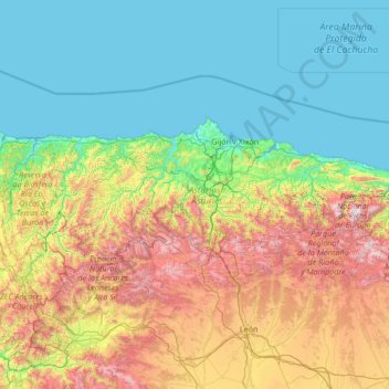
Name: Asturias topographic map, elevation, terrain.
Location: Asturias, Spain (42.88254 -7.18317 43.66653 -4.51059)
Average elevation: 565 m
Minimum elevation: -1 m
Maximum elevation: 2,528 m
Thank you for supporting this site ❤️
Make a donation
Make a donation
Other topographic maps
Click on a map to view its topography, its elevation and its terrain.