
Thank you for supporting this site ❤️
Make a donation
Make a donation
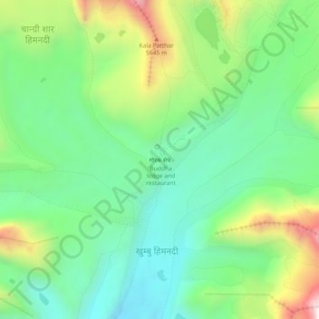
Gorak Shep topographic map
Click on the map to display elevation.
Thank you for supporting this site ❤️
Make a donation
Make a donation
Gorak Shep
Gorak Shep, also spelled Gorakshep (Nepali: गोरकशेप, गोरक्षेप), is a settlement nestled on the periphery of a frozen lakebed blanketed with sand in Nepal, sharing its name with the locale. Situated at an elevation of 5,164 meters (16,942 feet) near Mount Everest, it remains uninhabited for most of the year, reopening only for the Mount Everest trekking season.
Thank you for supporting this site ❤️
Make a donation
Make a donation
About this map
Name: Gorak Shep topographic map, elevation, terrain.
Average elevation: 5,255 m
Minimum elevation: 4,954 m
Maximum elevation: 5,871 m
Thank you for supporting this site ❤️
Make a donation
Make a donation
Other topographic maps
Click on a map to view its topography, its elevation and its terrain.