
Thank you for supporting this site ❤️
Make a donation
Make a donation
Fort Bridger topographic map
Click on the map to display elevation.
Thank you for supporting this site ❤️
Make a donation
Make a donation
About this map
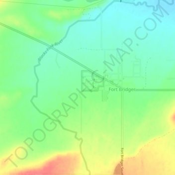
Name: Fort Bridger topographic map, elevation, terrain.
Location: Fort Bridger, Uinta County, Wyoming, United States (41.30140 -110.40554 41.33236 -110.37224)
Average elevation: 2,039 m
Minimum elevation: 2,015 m
Maximum elevation: 2,088 m
Thank you for supporting this site ❤️
Make a donation
Make a donation
Other topographic maps
Click on a map to view its topography, its elevation and its terrain.