
郊尾镇 topographic map
Interactive map
Click on the map to display elevation.
About this map
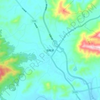
Name: 郊尾镇 topographic map, elevation, terrain.
Location: 郊尾镇, 仙游县, 莆田市, 福建省, 中国 (25.26651 118.79033 25.34651 118.87033)
Average elevation: 100 m
Minimum elevation: 9 m
Maximum elevation: 533 m
Other topographic maps
Click on a map to view its topography, its elevation and its terrain.