
Tella topographic map
Interactive map
Click on the map to display elevation.
About this map
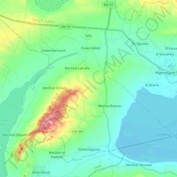
Name: Tella topographic map, elevation, terrain.
Location: Tella, Daïra Hammam Sokhna, Sétif, Algérie (35.89954 5.62264 36.02650 5.80965)
Average elevation: 911 m
Minimum elevation: 872 m
Maximum elevation: 1,053 m
Other topographic maps
Click on a map to view its topography, its elevation and its terrain.
Hammam Sokhna
Algérie > Sétif > Daïra Hammam Sokhna
Hammam Sokhna, Daïra Hammam Sokhna, Sétif, 19066, Algérie
Average elevation: 919 m