
City of Pirot topographic map
Interactive map
Click on the map to display elevation.
About this map
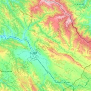
Name: City of Pirot topographic map, elevation, terrain.
Average elevation: 807 m
Minimum elevation: 282 m
Maximum elevation: 2,155 m
Other topographic maps
Click on a map to view its topography, its elevation and its terrain.
Midžor
Serbia > Central Serbia > Pirot Administrative District > City of Pirot
Average elevation: 1,810 m