
Mwenga topographic map
Interactive map
Click on the map to display elevation.
About this map
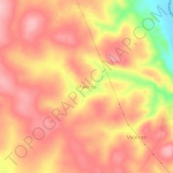
Name: Mwenga topographic map, elevation, terrain.
Location: Mwenga, Korogwe, Tanga, Northern Zone, Tanzanie (-5.11046 38.27626 -5.07046 38.31626)
Average elevation: 473 m
Minimum elevation: 365 m
Maximum elevation: 520 m
Other topographic maps
Click on a map to view its topography, its elevation and its terrain.