
Sint-Jozef-Rijkevorsel topographic map
Interactive map
Click on the map to display elevation.
About this map
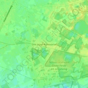
Name: Sint-Jozef-Rijkevorsel topographic map, elevation, terrain.
Average elevation: 26 m
Minimum elevation: 17 m
Maximum elevation: 33 m
Other topographic maps
Click on a map to view its topography, its elevation and its terrain.
Rijkevorsel
België > Antwerpen > Turnhout > Rijkevorsel
Rijkevorsel, Turnhout, Antwerpen, Vlaanderen, 2310, België
Average elevation: 24 m