
Abstäberhof topographic map
Interactive map
Click on the map to display elevation.
About this map
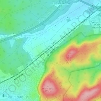
Name: Abstäberhof topographic map, elevation, terrain.
Average elevation: 278 m
Minimum elevation: 228 m
Maximum elevation: 386 m
Other topographic maps
Click on a map to view its topography, its elevation and its terrain.
Bayerisch Kohlhof
Deutschland > Saarland > Kirkel > Bayerisch Kohlhof
Bayerisch Kohlhof, Limbach, Kirkel, Saarpfalz-Kreis, Saarland, 66459, Deutschland
Average elevation: 256 m