
Pied Pouzin topographic map
Interactive map
Click on the map to display elevation.
About this map
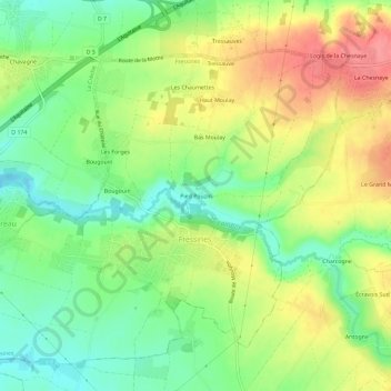
Name: Pied Pouzin topographic map, elevation, terrain.
Average elevation: 98 m
Minimum elevation: 62 m
Maximum elevation: 142 m
Other topographic maps
Click on a map to view its topography, its elevation and its terrain.
La Chesnaye
France > Nouvelle-Aquitaine > Deux-Sèvres > Fressines
La Chesnaye, Fressines, Niort, Deux-Sèvres, Nouvelle-Aquitaine, France métropolitaine, 79370, France
Average elevation: 99 m