
Peras Ruivas topographic map
Interactive map
Click on the map to display elevation.
About this map
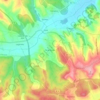
Name: Peras Ruivas topographic map, elevation, terrain.
Location: Peras Ruivas, Seiça, Ourém, Santarém, 2435-547, Portugal (39.63279 -8.56358 39.67279 -8.52358)
Average elevation: 179 m
Minimum elevation: 110 m
Maximum elevation: 265 m