
Faches topographic map
Interactive map
Click on the map to display elevation.
About this map
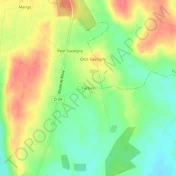
Name: Faches topographic map, elevation, terrain.
Average elevation: 242 m
Minimum elevation: 212 m
Maximum elevation: 273 m
Other topographic maps
Click on a map to view its topography, its elevation and its terrain.
Les Desserts
France > Bourgogne-Franche-Comté > Nièvre > Anlezy > Faches
Les Desserts, Faches, Anlezy, Nevers, Nièvre, Bourgogne-Franche-Comté, France métropolitaine, 58270, France
Average elevation: 234 m