
Thank you for supporting this site ❤️
Make a donation
Make a donation
Fronteira topographic map
Click on the map to display elevation.
Thank you for supporting this site ❤️
Make a donation
Make a donation
About this map
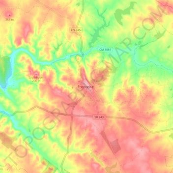
Name: Fronteira topographic map, elevation, terrain.
Location: Fronteira, Portalegre, 7460-139, Portugal (39.01581 -7.68787 39.09581 -7.60787)
Average elevation: 216 m
Minimum elevation: 154 m
Maximum elevation: 260 m
Thank you for supporting this site ❤️
Make a donation
Make a donation