
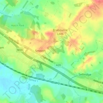
Smeeth topographic map
Interactive map
Click on the map to display elevation.
About this map
Name: Smeeth topographic map, elevation, terrain.
Average elevation: 67 m
Minimum elevation: 43 m
Maximum elevation: 102 m
Other topographic maps
Click on a map to view its topography, its elevation and its terrain.
Wittersham
United Kingdom > England > Kent > Ashford
Wittersham, Ashford, Kent, South East England, England, United Kingdom
Average elevation: 18 m
Shirkoak
United Kingdom > England > Kent > Ashford > Woodchurch > Shirkoak
Shirkoak, Woodchurch, Ashford, Kent, South East England, England, TN26 3QP, United Kingdom
Average elevation: 38 m
Repton
United Kingdom > England > Kent > Ashford
Repton, Repton Park, Orchard Heights, Ashford, Kent, South East England, England, United Kingdom
Average elevation: 55 m