
Thank you for supporting this site ❤️
Make a donation
Make a donation
Pommerloch topographic map
Click on the map to display elevation.
Thank you for supporting this site ❤️
Make a donation
Make a donation
About this map
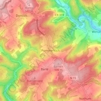
Name: Pommerloch topographic map, elevation, terrain.
Location: Pommerloch, Winseler, Canton Wiltz, 9638, Luxembourg (49.93953 5.84065 49.97953 5.88065)
Average elevation: 442 m
Minimum elevation: 325 m
Maximum elevation: 518 m
Thank you for supporting this site ❤️
Make a donation
Make a donation
Other topographic maps
Click on a map to view its topography, its elevation and its terrain.