
Thank you for supporting this site ❤️
Make a donation
Make a donation
Areraj topographic map
Click on the map to display elevation.
Thank you for supporting this site ❤️
Make a donation
Make a donation
About this map
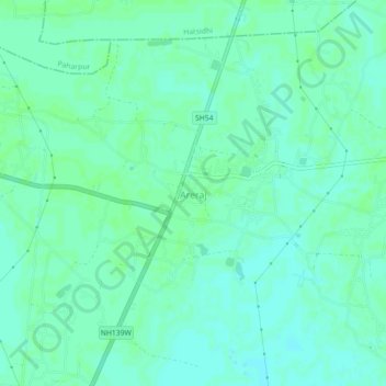
Name: Areraj topographic map, elevation, terrain.
Location: Areraj, Purba Champaran, Bihar, 845411, India (26.52859 84.64587 26.56859 84.68587)
Average elevation: 66 m
Minimum elevation: 62 m
Maximum elevation: 68 m
Thank you for supporting this site ❤️
Make a donation
Make a donation