
Thank you for supporting this site ❤️
Make a donation
Make a donation
Rotse topographic map
Click on the map to display elevation.
Thank you for supporting this site ❤️
Make a donation
Make a donation
About this map
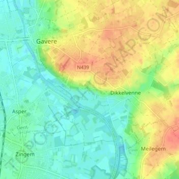
Name: Rotse topographic map, elevation, terrain.
Location: Rotse, Dikkelvenne, Gavere, Gent, Oost-Vlaanderen, 9890, België (50.89840 3.65666 50.93840 3.69666)
Average elevation: 22 m
Minimum elevation: 3 m
Maximum elevation: 48 m
Thank you for supporting this site ❤️
Make a donation
Make a donation