
Thank you for supporting this site ❤️
Make a donation
Make a donation
Kemzeke topographic map
Click on the map to display elevation.
Thank you for supporting this site ❤️
Make a donation
Make a donation
Kemzeke
Kemzeke is een landelijke gemeente, gelegen in Zandig Vlaanderen en het Waasland. De hoogte bedraagt ongeveer 5 meter. Er zijn nog unieke stukjes natuur te vinden zoals het Natuurreservaat De Gavers.
Thank you for supporting this site ❤️
Make a donation
Make a donation
About this map
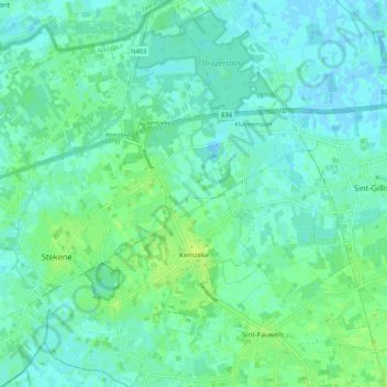
Name: Kemzeke topographic map, elevation, terrain.
Average elevation: 5 m
Minimum elevation: -5 m
Maximum elevation: 12 m
Thank you for supporting this site ❤️
Make a donation
Make a donation
Other topographic maps
Click on a map to view its topography, its elevation and its terrain.